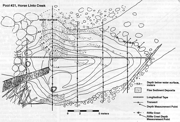
Figure 2--
Pool #21, Horse Linto Creek, showing location of the longitudinal tape, transects, measurement points for water and fine sediment depth, the riffle crest, and measurement points for riffle crest depth.
Back to V* paper